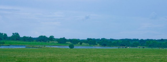
I’ve always liked this shot (taken in 2003 between Selma, Alabama and Montgomery, Alabama). The grass is green and the water and sky are blue–thanks in part to a little touch up work in Adobe Lightroom. I’m thinking of using this photo in a project I’m currently working on for the Southwest Alabama Rural Tourism group (www.alabamasfrontporches.com). It is in large part thanks to Adobe Lightroom that I’m even able to track it down. I’ve since gone through and done a better job of keywording some of my photos with place specific tags (they already have keywords relating to the specific city/town but not to the larger region. I’ve gone through and tagged about 500 or more with Southwest Alabama in addition to rural or byway or Marion or Greensboro. Hopefully, this will help me in this project and in the future.
tourism
Trip to the Black Belt
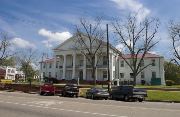
Enjoyed a late morning drive down Highway 5 to Marion, Alabama this past Wednesday. Met with the Cahaba Trace Commission to discuss scenic byways and their possible interest in having a section of their route designated as a byway. We met over lunch at a restaurant (Lottties, I think is the name) right off the courthouse square in Marion. What a beautiful courthouse, too. The food was actually good: fried okra, cole slaw and grilled pork chops. No bread, though. I think the large crowd had them a bit off their game.
Had an opportunity to meet with Nisa Miranda of the University of Alabama Economic Development Institute briefly. We discussed www.alabamasfrontporches.com for a few minutes before she headed off to Camden and then to Ezell’s in Lavaca (the cole slaw is much better at Ezells).
Scenic Byway Happenings
Lots of good stuff going on with Alabama’s Scenic Byways program. Yesterday, we met to review grant applications for five projects and rank them according to a combination of factors. Very exciting to see the projects we’ve been working on since 1999 taking root in the local community and moving forward. Byways have some of the best potential to generate quality tourism in Alabama, particularly in the more rural sections. We also approved a logo for the byways program. Similar design to what I originally did, but we added an additional pine cone. Interestingly enough, in doing research on branding destinations, I’ve found that the general consensus is that people spend the most time and effort on developing a logo and a logo is one of the least important features of community branding.
Today, I’m off to Marion, Alabama to talk to the Cahaba Trace Commission about their interest in a scenic byway along their route. We’re up to seven state scenic byways and three national byways, now, so the pressure to build the program is still there, but not as great as it was when we only had one. While in Marion, I’ll take advantage of the trip and do a little photography of some of the architecture and landscapes for potential use on the Southwest Alabama Regional Tourism website: alabamasfrontporches.org.
Lookout Mountain Parkway
Another Newsletter–for the Alabama Byways Program
 Seems as though I’m working on lots of newsletters these days. This is a newsletter I’ve intended to put together for a long time and just haven’t gotten around to it. This is the first newsletter for the Alabama Byways Program. Future issues will have more topical information including grant deadlines, tips and more, but for the first issue, it seemed a good idea to send out basic information about exactly what the program is.
I’ve been working on byways in Alabama since I took a job at Scenic Alabama back in 1999. I’ve long since left Scenic Alabama, but really fell in love with the byways program. It is one of those really great concepts that lets small communities around Alabama (or, in larger terms, around the country) band together to create something bigger than any of them can create on their own.
Growing up in rural Alabama (I’ve always referred to it as the edge of nowhere because people have actually heard of the middle of nowhere), I’ve always had a love of rural life and the small towns that exist nowhere else. The byways program is my chance to work with these communities. (I’ve also managed to work with Alabama communities on some other projects, too. More on that in another post on another day.)
To read the newsletter, just visit the Alabama Byways website: www.alabamabyways.org/news.htm.
And, in case you are wondering about the seagull, this was taken in February of last year along the beautiful Coastal Connection Corridor that runs from north of Orange Beach over to Dauphin Island and beyond.

